Thursday, January 30, 2014

barcelona :: formal | informal

When I first looked at a map of Ciutat Vella, Barcelona's old town, I filed it as informal, unplanned, medieval, etc. The more I learned about it, though, I came to realize it is a result of a process of many years of densification - in fact with a surprising level of underlying order. Here is a map of Barcino today with its original Roman grid overlaid. The red indicates straight avenues that were carved out of the urban fabric in the late 19th century. Notice how they are informed by the Cardo-Decumanus (darker black lines). 

This kind of organic change through the middle ages occurred all over the former Roman Empire, turning towns like Barcino into what we see below, and similarly Islamic cities like Aleppo and Damascus reclaimed their organic forms from the imposed Greek and Roman grids.

When urban blocks are too large for a human scale, transverse itineraries are created. This is the new road network seen below. But could we consider itineraries in a hierarchy - larger roads for autos, smaller roads for bikes and pedestrians? 


Tuesday, January 21, 2014

barcelona :: cardo maximus


[bcn] :: tracing the cardo maximus

Following the ancient cardo from Sant Antoni market to Encants by Plaça de les Glòries Catalanes. This was the original path to and from the city on a north/south axis. The path is intact today, though none of the buildings visible here are from roman times. Remains of those buildings do exist, but they are below current ground level.

Music: Miles Davis, "Solea" from Sketches of Spain

Monday, January 20, 2014

barcelona :: decumanus maximus


Starting at the water, I walked what was the decumanus maximus and continued on the same vector as far as I could go. Remarkably, I walked almost four and a half miles and climbed over 730 feet in elevation in straight line. This transect revealed different cultures of space.

Walking out from the oldest part of Barcelona (2000 year old Barcino) the people on the street were predominantly tourists. 


At the intersection of the Cardo and Decumanus Maximus. there is a plaza - a modern day forum. And like the Roman forum, this plaza is surrounded by important government buildings (Catalan Senate house and the Mayoral offices of Barcelona). 


As I walked out of Barcino I joined a river of people on Ave del Portal del Angel, a promenade along the famous department store El Corte Ingles. Having just come from the somewhat empty medieval part with its cathedrals, this sudden burst of shoppers was jarring. Is consumption the new religion?


As I continued past Placa de Catalunya I was reminded of Union Square in NYC. The pace, the traffic, the energy, as well as the urban form. Spatially, these two places feel very similar. Will have to compare these two squares at scale on a map at some point. I continued along Paseo de Gracia, Barcelona's Fifth Ave, Chome 5, Nanjing Rd West. High end retail in noble 19th century buildings, nostalgic cafes. The people in this part are a mix of tourists, international businesspeople, and locals.


As I continued I entered Gracia, a denser, older neighborhood that used to be an autonomous town before Barcelona annexed it. Gracia felt much more like a neighborhood, with regular people going about their lives. I saw very few tourists.


Coming out of Gracia, the grade began to steepen and I was quickly in the hills. Now the grain of the city was less dense and I saw few people on the street. Cars were driving much faster. Buildings were newer. No retail, no restaurants, the occasional cafe.


Still further I passed a soccer field in full use, and realized it was part of a complex that decked over a major freeway (B-5). This enabled me to continue on my path uninterrupted (no freeway obstruction, barrier, overpass - I didn’t even know it was there until I looked at the map and saw I was standing over it. I walked another quarter mile before a housing complex that could have been somewhere outside Denver ended the path.


Wednesday, January 15, 2014

barcelona :: centuriation


*Adaptation of the Roman site to the topography
The Roman wall and defensive towers around Barcino, the 2000 year-old city that was the beginnings of Barcelona, are centered on a very special intersection. The cardo decumanus is ground zero for the centuriation of the lands in the area, and was likely set out in a spiritual siting and orienting event by the Roman survey team about 4 BC. It would have been located based on three decisions*:

1) determine the decumanus maximus by observing the direction of the rising sun on the day of the founding.

2) determine the line that would become the cardo maximus, in this case the line orthogonal with the coastline.

3) determine the course of the parallel streets to be laid out over time.

*Busquets, Joan. Barcelona: the urban evolution of a compact city, 2005.


Saturday, January 11, 2014

barcelona :: (im)pression

The Ciutat Vella is the old part of Barcelona, and it is impressively dense. 

scale :: Everything is smaller and more compact. Garbage trucks, delivery trucks, stores, restaurants, cars. Buildings that average 5 or 6 stories tall are separated by streets that are sometimes as narrow as 3 meters.

flow :: The narrow streets are top-lit by indirect sunlight. Occasionally a corner building is gone, creating a small plaza, and more light. People are everywhere. Pedestrians, bikes, scooters and cars are in a languid dance, using micro adjustments to avoid collisions without breaking pace. Barcelona has the most scooters of any European city besides Rome. Refuse is removed every single day by specially designed trucks and dumpsters that open from the bottom. 

streetscape :: The streets are well organized - it is rare the pedestrian is without a pathway.


Tuesday, January 7, 2014

context | proposal | itinerary | methodology

the city and the city

a study of urban potential lies between the ideal city and the actual city - between the city and the city.

projective urbanism?

If there is to be a new urbanism, it will not be based on the twin fantasies of order and omnipotence; it will be the staging of uncertainty; it will no longer be concerned with the arrangement of more or less permanent objects but with the irrigation of territories with potential; it will no longer aim for stable configurations but for the creation of enabling fields that accommodate processes that refuse to be crystallized into definitive form; it will no longer be about meticulous definition, the imposition of limits, but about expanding notions, denying boundaries, not about separating and identifying entities, but about discovering unnameable hybrids; it will no longer be obsessed with the city but with the manipulation of infrastructure for endless intensifications and diversifications, shortcuts and redistributions - the invention of psychological space.
Rem Koolhaas (S,M,L,XL: Whatever happened to Urbanism?)

From the number of imaginable cities we must exclude those whose elements are assembled without a connecting thread, an inner rule, a perspective, a discourse.  
Italo Calvino (Invisible Cities) 


context

It is impossible to simultaneously design a complex entity such as a city, because architectural space is created by three influences: the designer, the users, and time. If the goal for our cities is to elegantly accommodate more residents, use resources more wisely, and brace against changing climate patterns, then it is crucial to understand the mechanisms at work. Could we then harness these mechanisms to guide more incremental growth, rather than impose ideals of the time (or of times gone by) with giant projects that attempt to rewrite the given urban construct.

proposal

What in the city can be ordered and optimized, and what must be left to evolve naturally? Where is the line between the ideal and the authentic? How does that line move with physical and cultural latitude?

While building codes guide development to some extent, they do not effectively guide collective building form. Form-based codes assure density with a particular massing, but are often too restrictive and prohibit the natural evolution of the city. Architects must look to the space that is created by built forms - both inside and out - to understand how that space accommodates flows operating in larger networks or patterns. What bigger story are these mechanisms telling us, and how do we find them?

Some mechanisms are obvious, like the grid, but others are most evident where they overlap or break. Overlaps or breakage are moments in space and time where the city is changing or has the potential to change. Whether that change is evolution or not depends on how the mechanisms are harnessed. By teasing the ideal city from the actual city, or vice versa, we can begin to map what was intended against what actually is there, and trace these differentials back to the flows they accommodate - people, energy, water, and capital. Understanding these mechanisms is key to urban resilience. Therefore, a study of urban potential lies somewhere between the ideal city and the actual city - between the city and the city.

itinerary

\\ mediterranean \\ 32 - 45 deg N
0108 - 0209 \\ spain 
0209 - 0317 \\ italy
0317 - 0416 \\ morocco 
0416 - 0506 \\ france

0506 - 0609 \\ san francisco + new york

\\ south pacific \\ 06 deg S - 01 deg N
0609 - 0701 \\ singapore
0701 - 0730 \\ indonesia

0812 - 0830 \\ san francisco

\\ latin america \\ 29 deg S - 19 deg N
0830 - 0925 \\ peru
0925 - 1028 \\ brazil
1028 - 1201 \\ mexico

\\ northern europe \\ 49 - 52 deg N
1201 - 1231 \\ netherlands


Methodology

Observe, document and compare ordering mechanisms, networks and flows amid the following layers of the city:

\\ site
topography, hydrology, biome (flora, fauna, climate: latitude, humidity, elevation)

\\ pre-urban
land use and ownership before the city, regional networks before the city

\\ urban tissue
roads, land parcels 

\\ buildings
typology, informal to formal to informal, continuity/breakage

\\ objects
cars, vendor stands and carts, street furniture, lights, sidewalks, signs, etc


Documentation

\\ mapping
site, pre-urban, urban tissue, building footprints, flows, networks

\\ spatial analysis
sketches, drawings and photography to dissect and analyze spaces of interest

\\ time lapse video
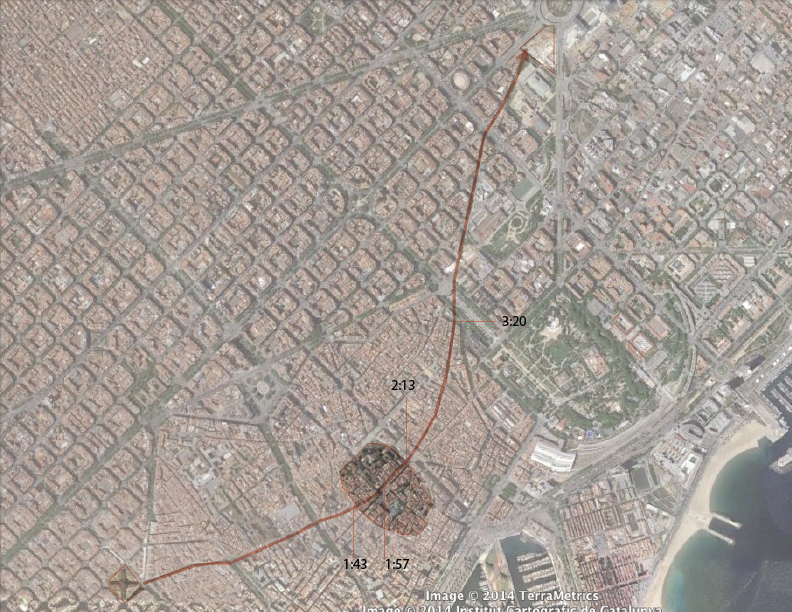
visualize flows through a site by montaging multiple itineraries and test for emergent order

\\ sky horizon face
daily images to track lighting conditions in different places and different times

\\ compression photography
streetscape images every 30 - 50 paces overlaid to compress time and space

\\ self-trace
mapping my own flow in each place of study